Prior to World War II, the Indian Ocean was an important maritime trade route between European nations and their colonial territories. In 1940, the Japanese officially joined the Germans in the WWII. Naval presence was dominated by the Royal Navy Eastern Fleet that included ships of the Royal Australian Navy. Axis naval forces gave a high priority to disrupting Allied trade in the Indian Ocean. The Japanese Navy developed Operation C, a plan for an aggressive raid into the Indian Ocean in early April. Operation C aimed to destroy the British Eastern Fleet, and disrupt British lines of communications in the Bay of Bengal in support of the Burma Campaign. Martial law was prevailing all over the island. The geographic position of Mauritius was favorable for the British. The attack on Mauritius was subsequently more prone. A naval and military base were constructed by the British to counter any attack from Japanese. The supply station for ships was reopened at Old Grand Port, and an aerodrome was also constructed at Plaisance while a seaplane base was inaugurated at Tombeau Bay. Military barracks were constructed on several strategic and vulnerable areas on the coastal regions. The inhabitants were requested to dig trenches which might have been used as shelter in case of aerial attacks. Certain schools were closed for military purposes while some buildings were requisitioned by the British for military use. The spying phobia among the British government was such to an extent that some Mauritians were detained in the Military Prison at Phoenix as a preventive measure. Mauritius had its own local armed militia corps. Territorial Force founded in 1934 was renamed Mauritius Regiment. Simultaneously, the Home Guard – later renamed as the Mauritius Defence Force – the Coastal Squadron and the Mauritius Auxilliary Defence Force were formed on the 9th November, 1943, and the King’s African Rifles regiment company – comprising mainly of Kenyans and Ugandans – set their military base on the island.
During WWll (1939 – 1945), During WWll (1939 – 1945), the east coast of Mauritius, the Royal Naval Air Station at Plaisance, some of the country’s neighbouring islands and the extensive camp at Le Chaland are significant physical reminders of the complex and evolving relationship between Mauritius and the British Empire during the course of WWII. While Mauritius itself was not attacked, there was a strongly perceived threat until the Battle of Midway in June 1942. Mauritius was, however, of significant importance in the hunt for enemy submarines and warships in the western Indian Ocean.
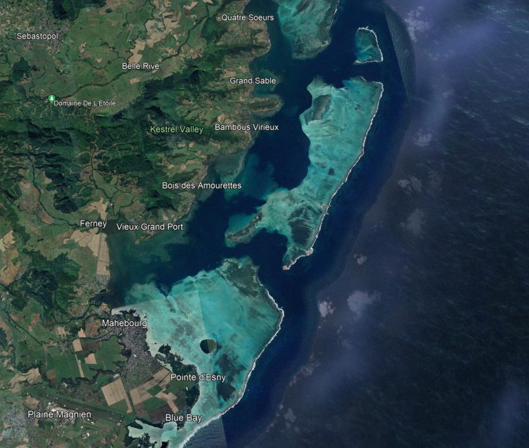
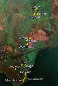
World War Il Military Installations on the Southeast Coast of Mauritius
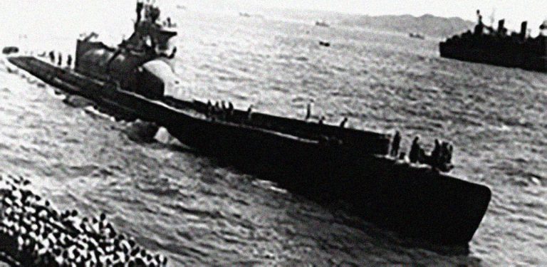
During World War II Mauritius became an important base for the Royal Navy fleet in the Indian Ocean. It served to hunt Japanese and German supply ships. As well as being part of the Navy’s wireless network across the Indian Ocean, Mauritius had a Wireless Interception Centre that proved an important addition to the Far East Combined Bureau, the region’s main Bletchley Park Outstation intercepting Vichy French and Japanese military and diplomatic codes. It was also a base for SOE activity against neighbouring Vichy French territories. It was also where warships intercepted Vichy French blockade-runners travelling between Indo-China, Madagascar and Europe.
A number of installations were constructed for coastal defense in the event of bombardment or attempted invasion as well as for the storage of fuel and ammunition. The east coast of Mauritius was protected by four WWII batteries, each equipped with guns and searchlights. Batteries at Pointe aux Feuilles, Pointe du Diable, Ile de la Passe and Ile aux Aigrettes were all manned by No.2 coast battery. At the summit of Pointe du Diable there was a Fire Control post and a lighthouse on Ile aux Fouquets. A jetty, pumping station and pipes, five Royal Navy fuel tanks and associated facilities were constructed at Bois des Amourettes. Defensive structures were built on the Old French Batterie de la Reine and on the slope of Lion Mountain. Between Pointe Vacoas and Blue Bay, mostly to the south-eastern coast of the island Mauritius, a very large number of building platforms could be seen. These form part of camps built to accommodate some 7000 men recruited by civil labour corps in 1942. In 1949, this camp was used as a training base for Royal Pioneers cops where Mauritian and other volunteers were trained before being sent elsewhere to some British Empire.
Overview of southeast coast of Mauritius
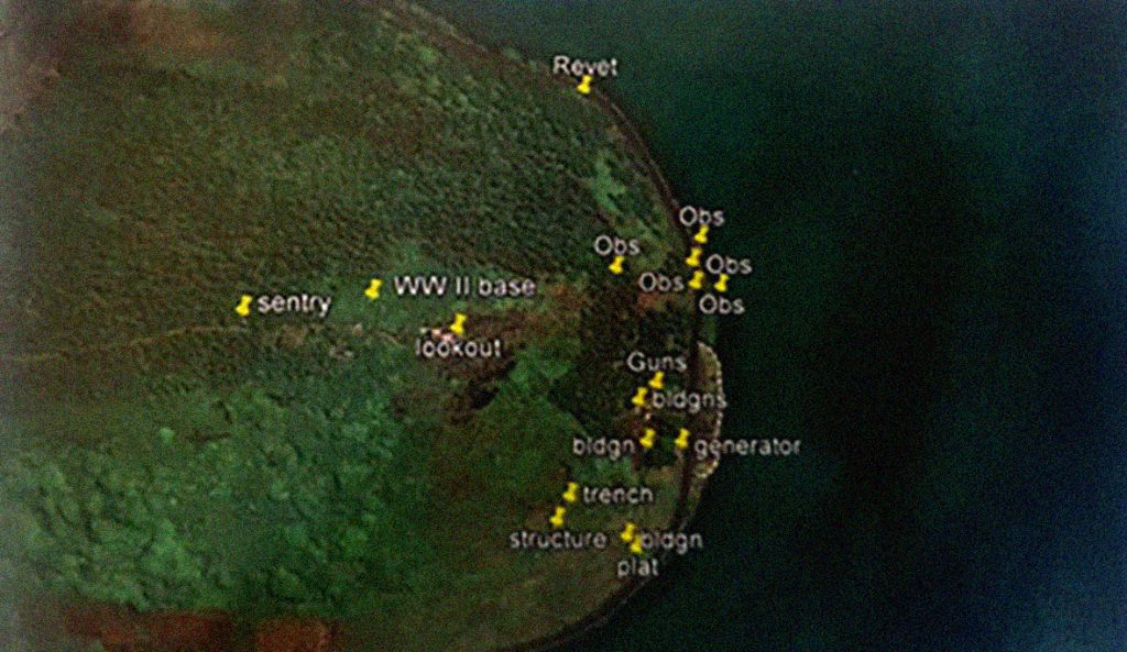
World War II Military Installations at Pointe du Diable
Pointe du Diable WWII features
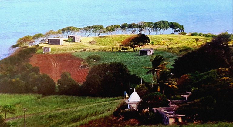
Pointe du Diable protected the deep channel leading to the bay of Grand Port from the North entrance. In WWII there were several components to the military installations. Some were at the foot of the pluff, some on the slopes and others on summit. During WWII, the British reinforced all structures to counter any attack from the enemies. The WWII, battery is situated to the west of and a few metres above the main road. Weaponry comprised two 6” Mk VII BL guns. There are several associated buildings terraced into the hillside. Today these structures are home to goats , chicken and geese and some used as workshops.
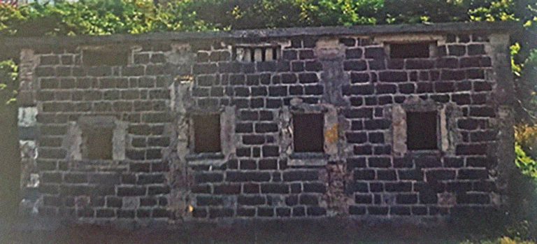
Front façade of generator building, Point du Diable WW I
Observation posts on the shore, Pointe du Diable WW II
World War II Military Installations at Pointe aux Feuilles
Pointe aux Feuilles was the northernmost of the four batteries guarding Grand Port bay. It was located directly opposite the North Entrance through the reef, and surveyed the channel which led to the mouth of Grand River Southeast as well as the channel running to the south, past Pointe du Diable to Grand Port. The following structures were identified : fuel reserves, searchlights, 2 Mk II CP and 2 90mm 30 FL guns.
Pointe aux Feuilles with a WWII building, gunpits and other structures
Northern Observation Post at Pointe aux Feuilles
Southern Observation Post at Pointe aux Feuilles
Pointe aux Feuilles generator room
Magazine Corridor at Pointe aux Feuilles
World War II Military Installations at Batterie de la Reine
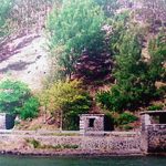
During WWII, defensive buildings were erected at Batterie de la Reine. The objective was to guard against fastmoving light attack crafts in the channel between the Batterie de la Reine and Ile aux Aigrettes.
Batterie de la Reine WWII features
Batterie de la Reine and WWII structures (blockhouses)
World War II Military Installations at Bois des Amourettes
Pointe du Diable WWII features
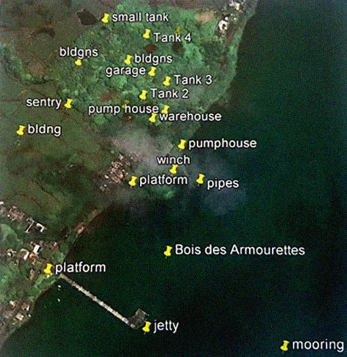
At Bois des Amourettes, a Royal Navy facility was constructed for the storage of fuel. Construction began in 1942 and was undertaken by the civil labour corps for the Royal Navy. The site was extensive and bears testimony to the size of the investment that was made to defend the Empire. By 1942 the principle threat was perceived as coming from Japan, although German submarines were also active in Indian Ocean. The facility at Bois des Amourettes was constructed basically for search operations by the Royal Navy and Royal Air Force rather than for purpose of coastal defence.
World War II Military Installations – The Jetty
The jetty was constructed in WWII. The WWII jetty was L-shaped with a small guard post at the end used mainly for Catalina flying boats to dock or be moved. At the end of the jetty, large WWII building platforms were constructed to store fuel for Catalina flying boats.